+7.5 C ESE kmph Mixed clouds and blue sky.
Well spring has arrived in Igloolik. The tundra is almost completely free of snow and there are more birds everyday. I have tarped my snow machine and kitted my bike out for exploring. Hazing kit and bear spray in the blue bag; food and repair kit in the panniers and survival / 1st aid gear in my pack.
The roads around the island aren't too bad and in places there are good atv trails as well.
Local heading out to Little Fish lake to try his luck with his kayak.
The melt has opened up the formerly undersnow terrestrial world for exploration. Some of the most striking features have been coming across remains of old Inuit camps with remenants of sod houses and the bones from harvests past - mostly walrus.
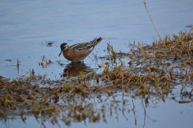
On recent forays have been photographing plants to start learning arctic flora and birds when I get the chance. There are not huge numbers of birds yet but I'm up to 18 species of which 11 are new to me including long-tailed jaegar, arctic tern, red-throated loon, red phalarope, king and common eider, lapland longspur, baird's and white-rumped sandpipers.
The area hasn't completely given over to spring although you won't know it from these hardy kids. Theo said he used to swim in ponds as a kid and that often when their feet touched the bottom it was permafrost.
Turton Bay in front of town and most of the ocean in this general area is still frozen over. There are large cracks, smaller areas of open water and pools of meltwater covering the ice, people are still heading out daily by skidoo to hunt seal or fish char through the ice. Theo said that speeding across open cracks is very doable and he has crossed quite wide cracks by going so fast that the machine skips across the open water.
The Rock the Walrus Arts Festival just wrapped up. There were 3 days of music and arts workshops (carving, music, acting, etc.) and performances. I missed the night that a perfomer from Greenland apparently really got the crowd going and the music went on into the morning hours. I saw some local singers, dancers, throat singers and a storyteller.

The storyteller told about being young in Repulse Bay and the arrival of a plane one Christmas that threw off 6 Christmas trees. They stayed on the ground where they were unloaded because no one had seen a tree before and they couldn't figure out what they were for. Later, in the summer the kids were hitting a rubber ball around with a piece of lumber that eventually broke. They thought of the Christmas trees and cleared the branches off of one. After some shaping work they had a bat and they came to greatly appreciate the Christmas trees. They converted each tree into a bat as the previous one wore out. He said the trees turned out to be one of the best gifts ever. The festival was a big success. The night I was there the school gym was full to overflowing.
Many people now spend most of there time out at their family summer camps staying in small cabins or canvas tents.From those spots along the shore they hunt, fish and collect eggs.
I recently returned from a week long trip where we visited Foxe Basin communities to pass on the results of 2 years of aerial surveys for polar bears in Foxe Basin. The surveys showed the numbers to be essentially the same as 20 years ago so good news and confirmation of what the communities have been saying.
Our route took us to Chesterfield Inlet, Coral Harbour, Repulse Bay, Cape Dorset, Iqaluit and back to Igloolik. The Hunter and Trapper Organizations we met with are comprised of people who are very knowledgeable about being out on the land. Fascinating people to meet, talk with and listen to. Lots of traditional knowledge (IQ) was shared. It's one thing to read about and another to hear directly from an elder whose face bears the weathering of a lifetime on the land.
Each community was very different as were the settings. It was possible to get out and about between meetings.
Chesterfield Inlet (pop 313) is Nunavut's oldest permanent community and had a historic school and turberculosis sanitorium run by a Catholic Order (see pics from my earlier visit to Chesterfield Inlet). I saw my first common eider ducks on the open water water between floating blocks of ice in the bay.
Coral Harbour (pop 834) on Southampton Island is named for the fossilzed coral found on land and in the waters around the island. This is a birding hotspot with 2 bird sanctuaries where large numbers of tundra swans, 2 species of geese, common and king eiders, long-tailed ducks and many other species nest. The island was used by 1000s of years by Thule people, the people before the modern Inuit. One archaeological site is called the "lost city of the North".


Repulse Bay (pop 945) was the most northerly whaling station in the 1800s. Inuit would travel from as far away as Igloolik to work with the whalers and to trade furs (Ice Master by Jame Houston is a good read about the whaling of that time). Repulse residents are still involved in whaling as are many Nunavut communities. In Repulse they have selected a team to again hunt a bowhead whale this year. In other communities they hunt beluga and narwhal. We visited the site where the bones from past hunts remain. On the same point are the ancient remains of many structures built of lichen-covered rocks including a stone enclosure designed to trap fox.
The headquarters of Ukkusiksalik NP is located in town and crossed paths with former Pac Rim employee Rob Campbell. Rob is the acting manager and had many stories to tell of travelling the area with residents. The park area sounds amazing with an abundance of wildlife, fish, historical site and natural features like a reversing falls.
Kinngait / Cape Dorset (pop 1,363) is on Baffin Island (Baffin Island is the 5th largest island in the world an is bigger than the United Kingdom) and is the birthplace of the West Baffin Eskimo Cooperative established in the 1950s. The setting of the community is very dramatic on a bay backed by low mountains.
The art workshop / studios are filled with amazing works that get shipped out all over the world. James Houston's book Confessions of an Igloo Dweller tells the story of the bringing of Inuit art to the rest of the world.
The bay was mostly open with many small icebergs when we arrived and the next day when the wind shifted it was completely blocked with floating ice. A dramatic example of how quickly conditions can change.
Back home in Igloolik a few days ago I witnessed the dynamic nature of conditions once again. We had driven out to Igloolik Point to remove a damaged electric fence around a site used to cache walrus meat in holes dug into the beach gravel.
 |
| Walrus cache site where Theo and friends were attacked by 3 polar bears last Christmas. The walrus meat is buried in the beach gravel to ferment for up to 6 months. |
The day was one of the warmest and sunniest so far. There are a number of archaeological sites along the way.
 |
| Grave of Green Mate Elder who died in 1823. The boats the Fury and the Hecla overwintered on Igloolik Island. |
As we got closer to Igloolik Point there were small patches of open water off along the shore. People we talked to said things had opened up just in the past few hours.
One group was a film crew getting set up. Two of their skidoos had gone off floating on ice when the ice broke up off their camp overnight.
Further on we met an ecotourism group.
The previous night they had left their encampment and travelled by skidoo and qamutiiq over the sea ice to a large lead of open water called the floe edge. From there they put their zodiac in the water and travelled to an open water area where they enjoyed the company of 40-50 bowhead whales.
 |
| There are 2 qamutiiqs floating on ice floes in the distance. |
They made it back to their tents at 0200. The next morning they awoke to find that the expanse of sea ice in front of camp broken up. Some skidoos, qamutiiqs and canoes were now adrift on floating blocks of ice which we could see for oursleves. Recovery efforts were underway and it was expected everything would be recovered. In the picture above there are 2 qamutiiqs on those offshore ice floes.
Two days later we returned to check on another fence and the whole shore area was open water for 100s of meters out. There were many arctic terns in the air and flocks of long-tailed and eider ducks on the water. Back in town everyone watches the frozen bay in front of town for signs of break up.